


GR78 - Etape 4 Quartier de la gare - Sabarthès

patoche2009
User
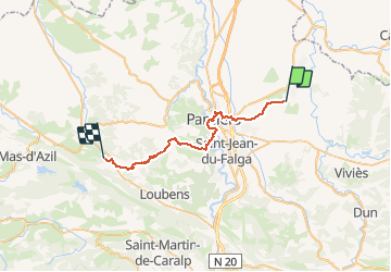

Length
32 km

Max alt
539 m

Uphill gradient
552 m
Km-Effort
39 km

Min alt
280 m

Downhill gradient
531 m
Boucle
No
Creation date :
2017-02-25 00:00:00.0
Updated on :
2017-02-25 00:00:00.0
8h18
Difficulty : Easy

FREE GPS app for hiking
 SityTrail
IGN / Geographical institutes
SityTrail Plus
The world is yours!
About
Trail Walking of 32 km to be discovered at Occitania, Ariège, Le Carlaret. This trail is proposed by patoche2009.
Description
Voir étape 1 Carcassonne - Ville neuve les Montréal
Positioning
Country:
France
Region :
Occitania
Department/Province :
Ariège
Municipality :
Le Carlaret
Location:
Unknown
Start:(Dec)
Start:(UTM)
394267 ; 4776090 (31T) N.
Comments